San Francisco Board of Supervisors Redistricting Kit
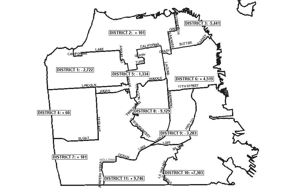
- Overview map (image). A map of the entire city, indicating current districts, relevant street designations, and the amount by which each district is over or under its ideal population size.
- Maps of current districts. Maps depict San Francisco"s 11 current Supervisorial districts, divided into block groups as delineated by the U.S. Census Bureau. Maps indicate the census Block Group number and population of each block group. Maps also indicate the amount by which each district is above or below it"s target population size.
- Legal description of current boundaries from the City Charter.
- Criteria to be used in drawing up new Supervisorial districts (memo, "Redistricting Overview," by Chad Jacobs) (MS Word).
- Census 2000 Population of all Supervisorial districts by Race and Ethnicity (Ms Excel).
- Census 2000 Population of all Census Block Groups in each Supervisorial district.
Block Group Data (MS Excel)
Block Group Worksheet (MS Word)