SF District Maps & Data
At the March 28, 2002 Special Task Force meeting at City Hall, directions were given to the Task Force technical consultant regarding the creation of preliminary district maps. Two of these maps were presented by the technical consultant at the April 1, 2002 Task Force meeting. The Task Force will display the maps at future meetings and encourages community feedback.
You can see the preliminary maps by clicking on the links below. You can also pick up a printout of preliminary plans at the Department of Elections or at future Task Force meetings.
Preliminary Plan 1
Plan 1 Statistics (MS Excel)
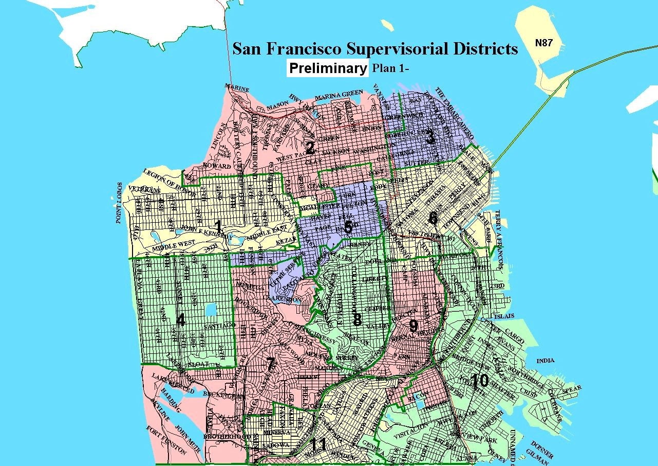
Plan 1 11-District Map (image)
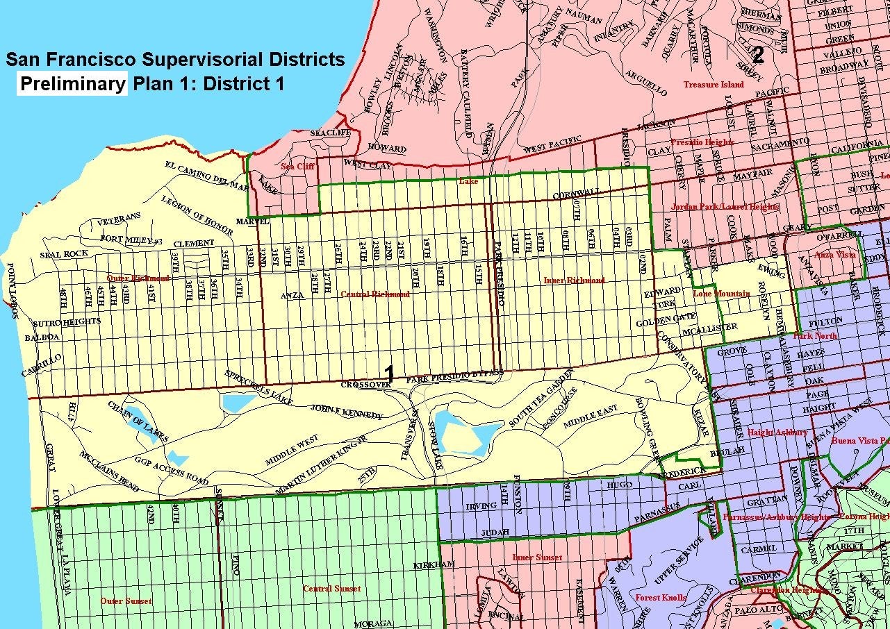
Plan 1 District 1 Map (image)
Plan 1 District 2 Map (image)
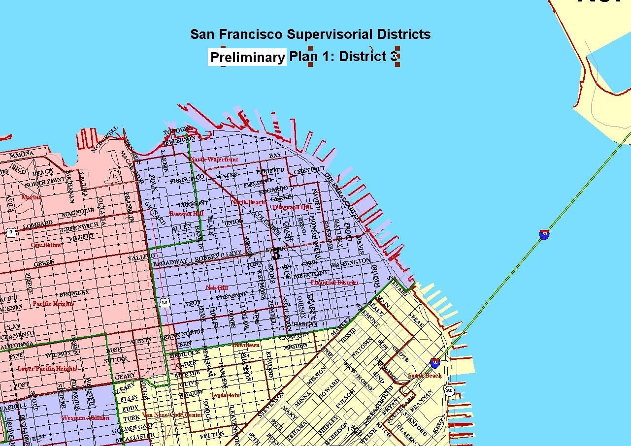
Plan 1 District 3 Map (image)
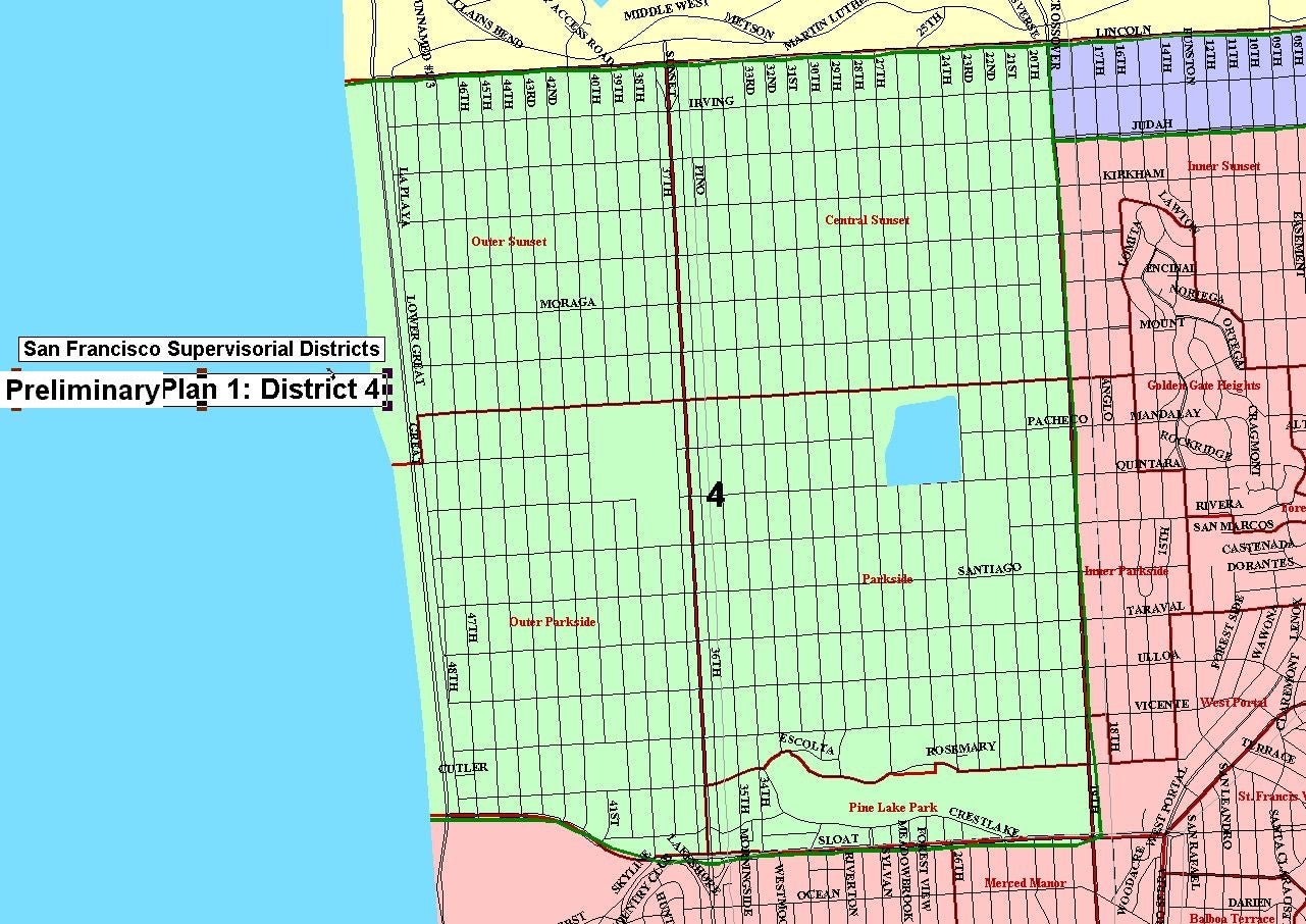
Plan 1 District 4 Map (image)
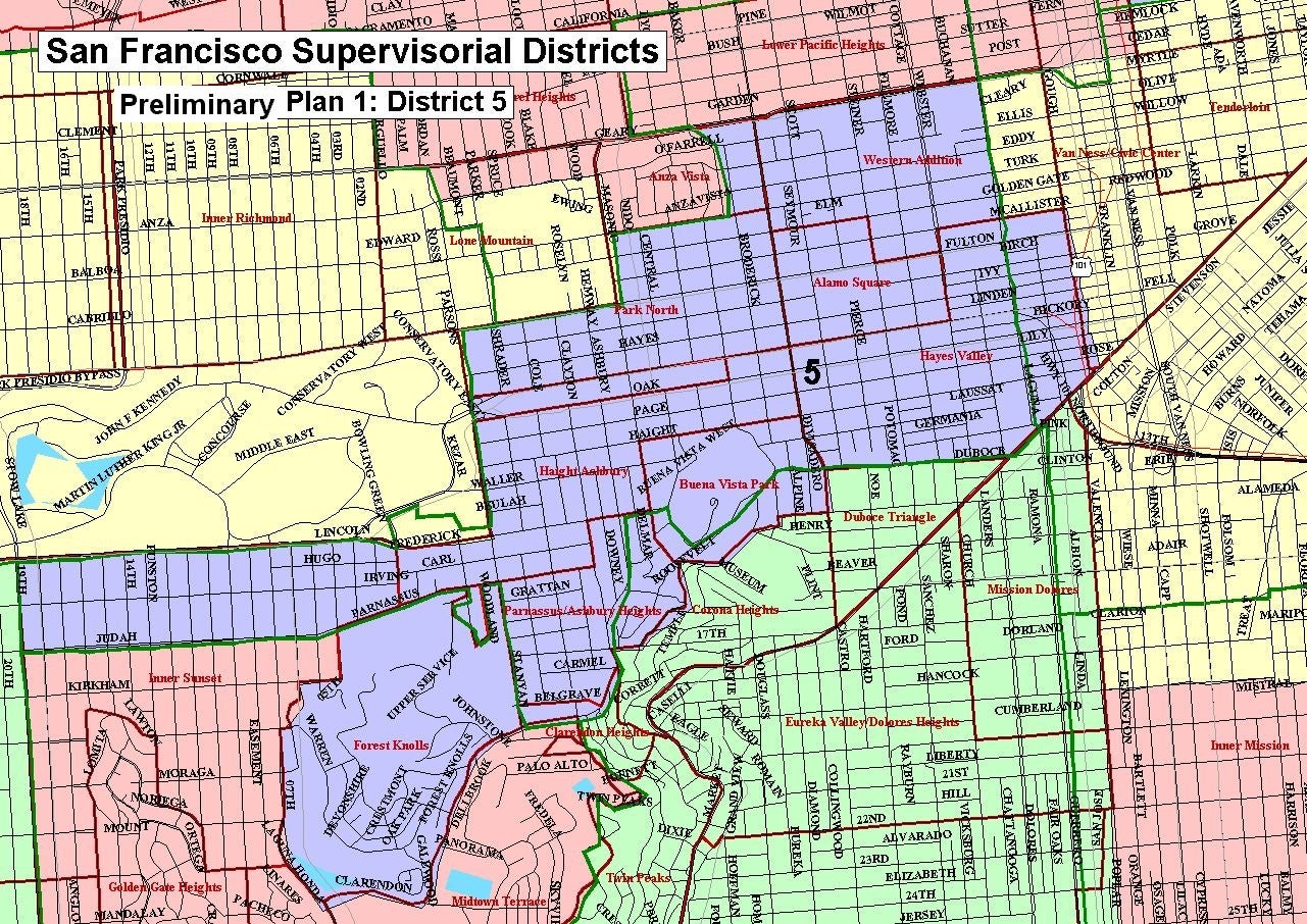
Plan 1 District 5 Map (image)
Plan 1 District 6 Map (image)
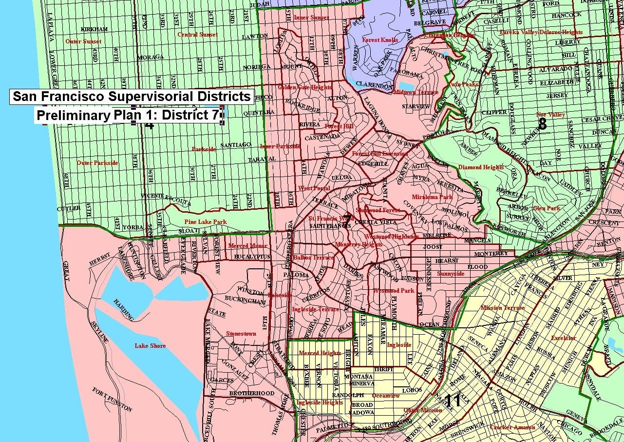
Plan 1 District 7 Map (image)
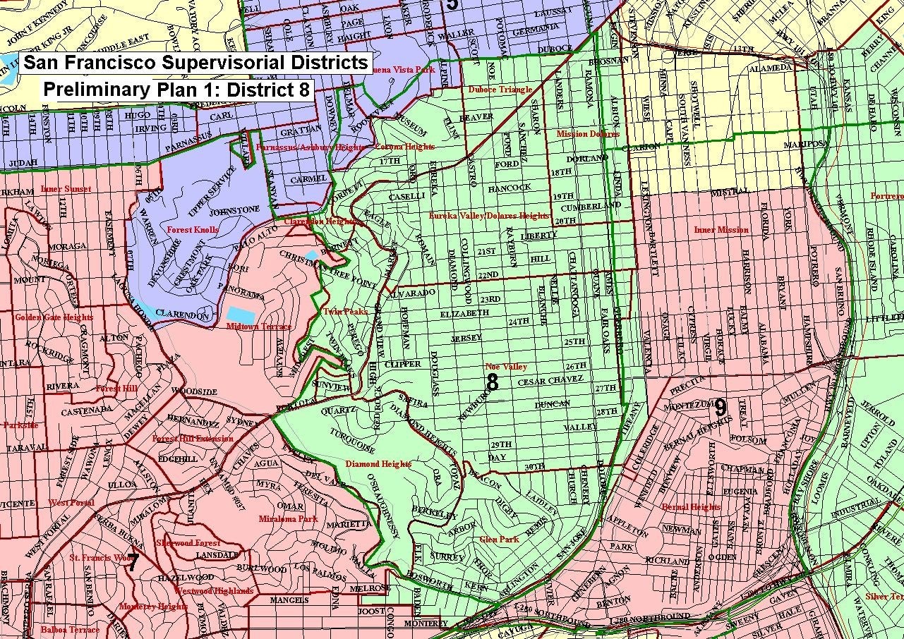
Plan 1 District 8 Map (image)
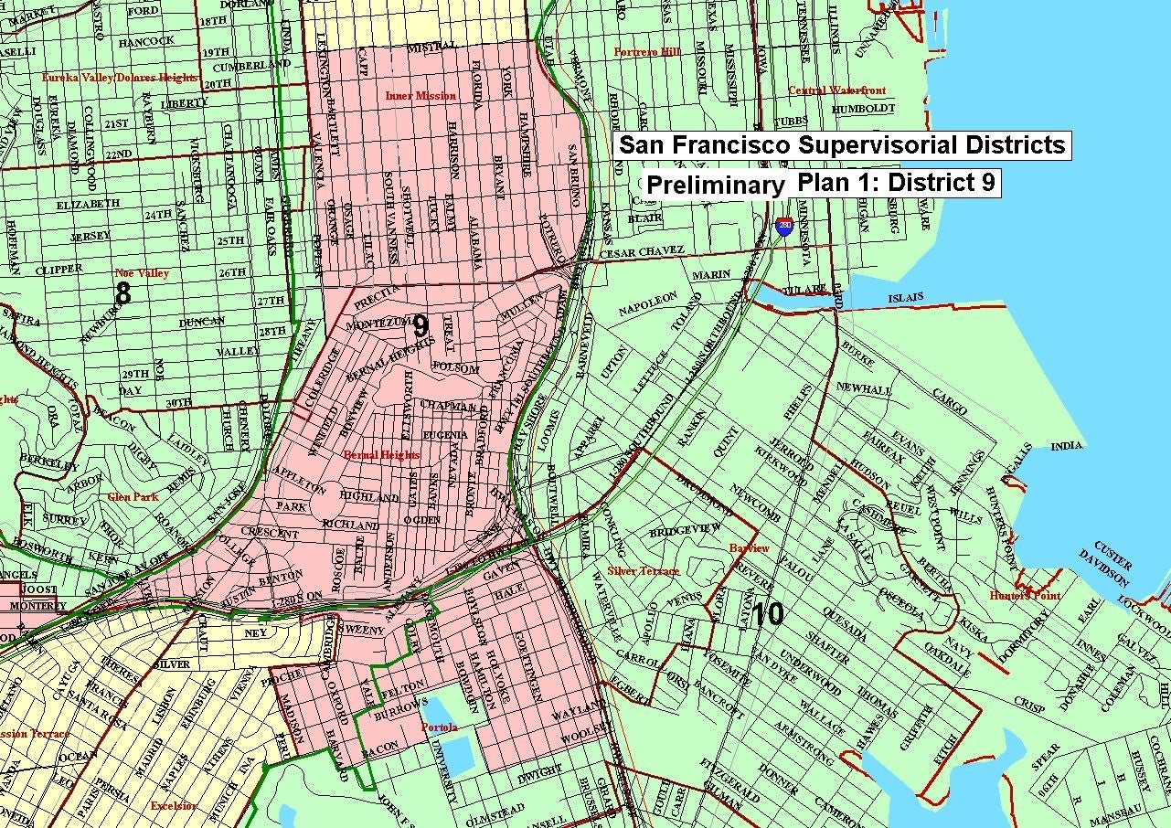
Plan 1 District 9 Map (image)
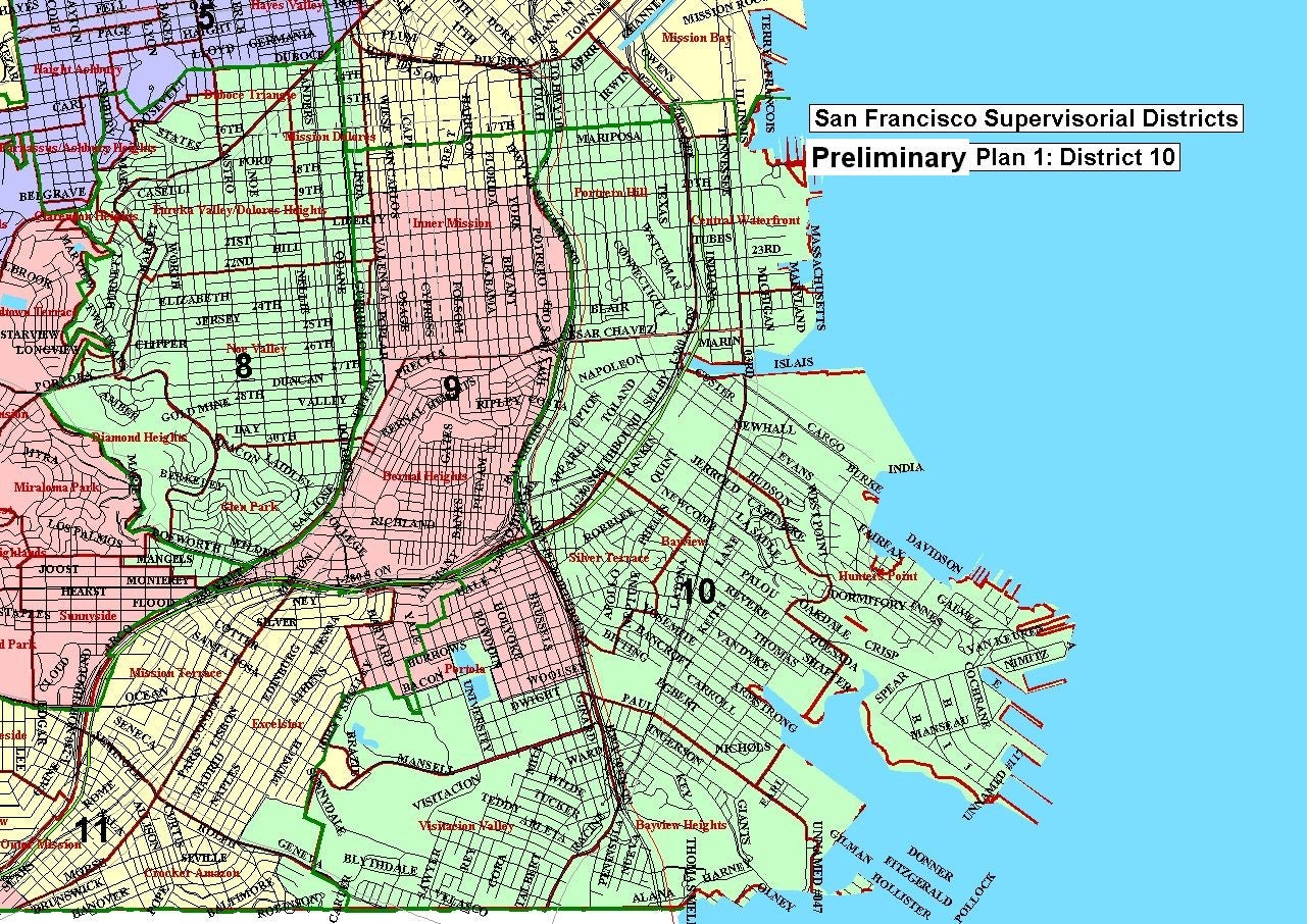
Plan 1 District 10 Map (image)
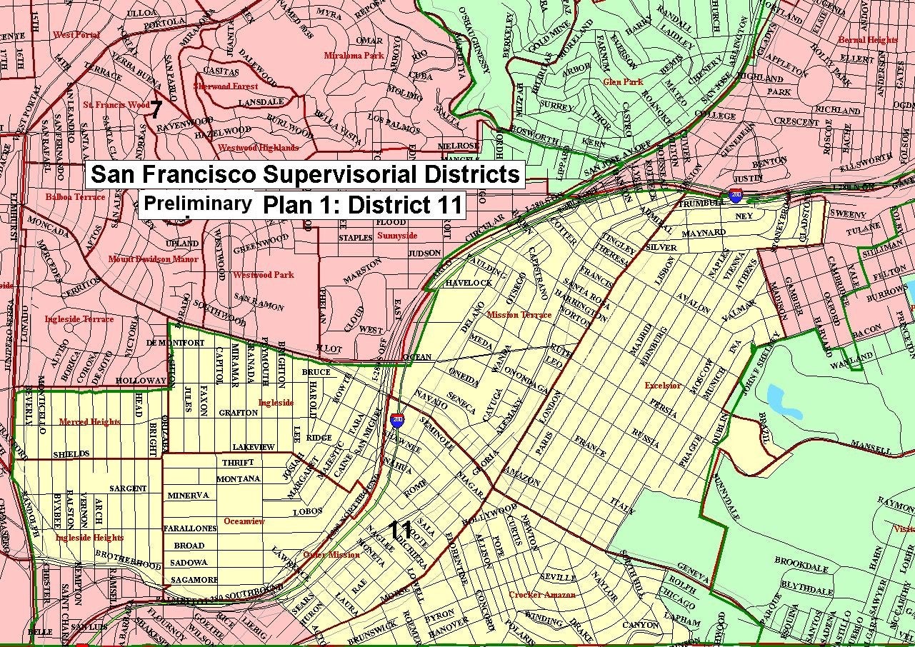
Plan 1 District 11 Map (image)
Preliminary Plan 2
Plan 2 Statistics (MS Excel)
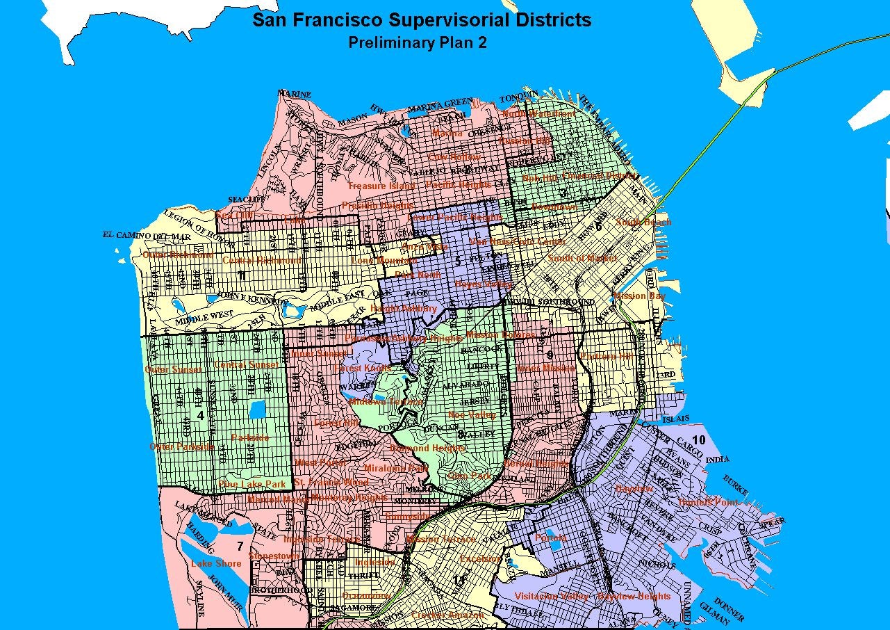
Plan 2 11-District Map (image)
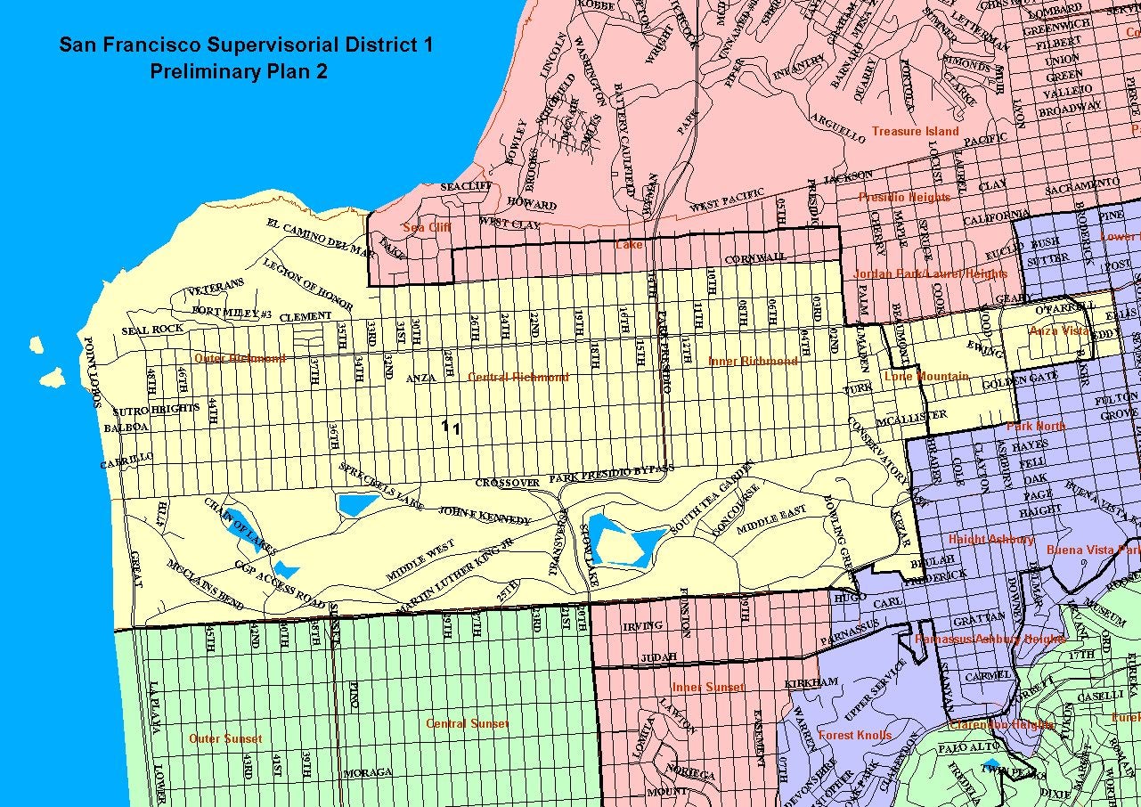
Plan 2 District 1 Map (image)
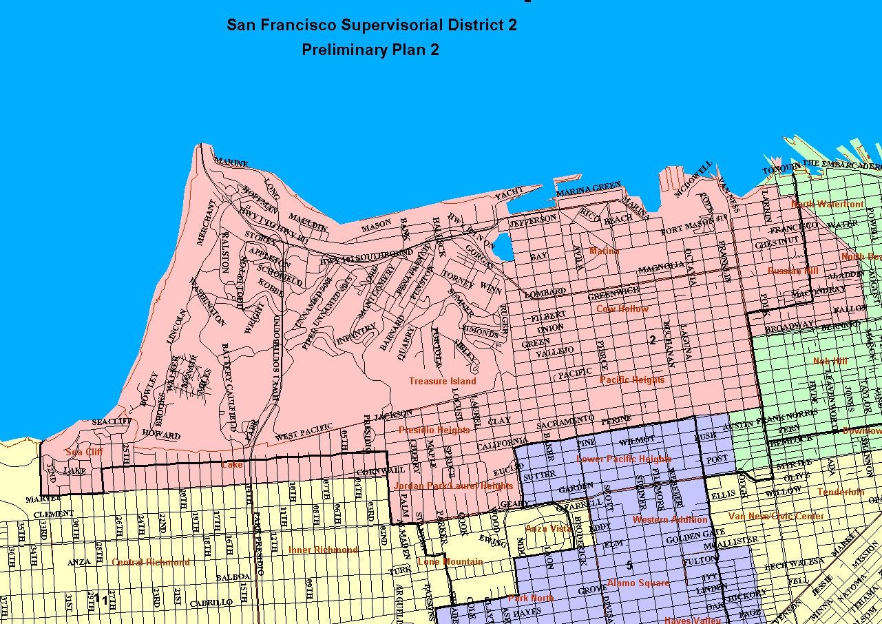
Plan 2 District 2 Map (image)
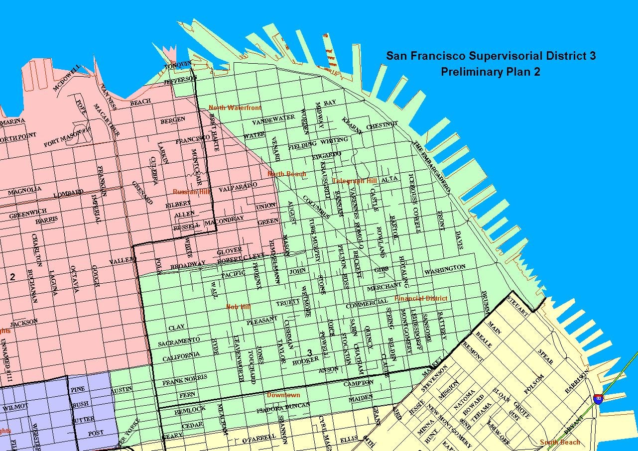
Plan 2 District 3 Map (image)
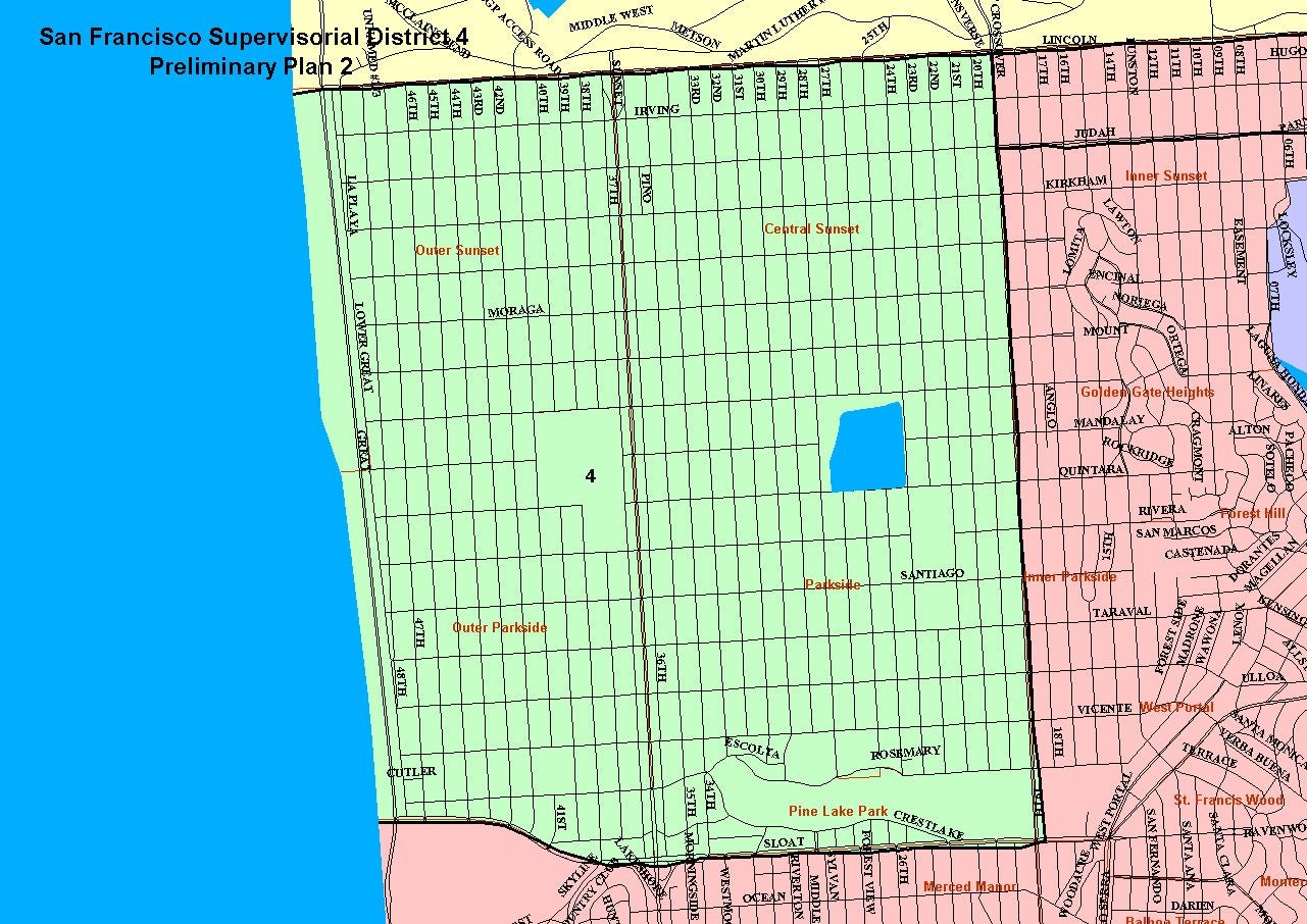
Plan 2 District 4 Map (image)
Plan 2 District 5 Map (image)
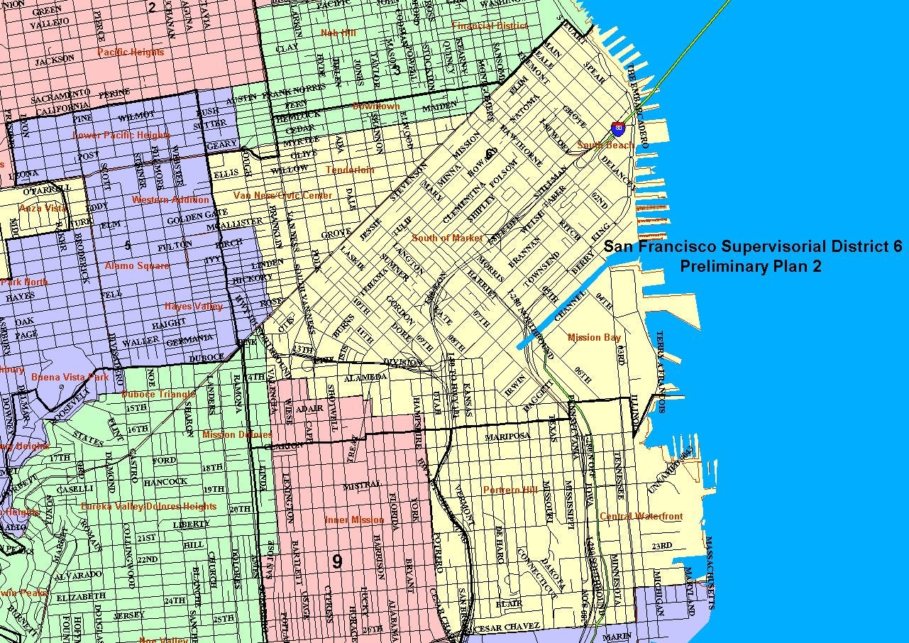
Plan 2 District 6 Map (image)
Plan 2 District 7 Map (image)
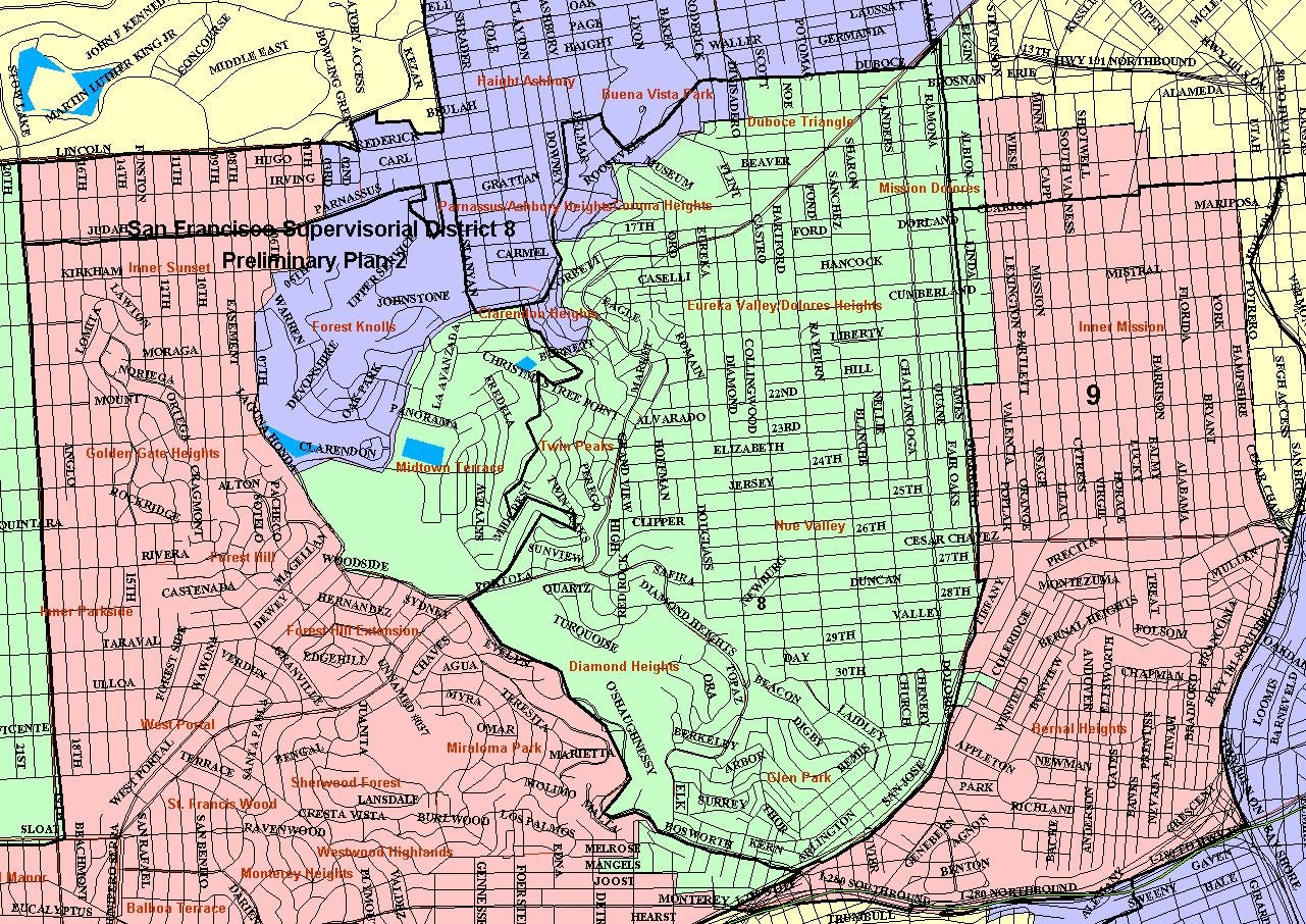
Plan 2 District 8 Map (image)
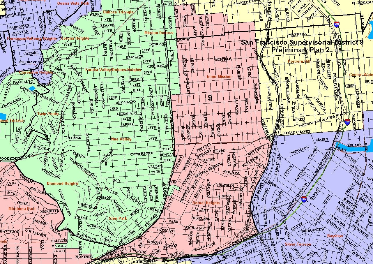
Plan 2 District 9 Map (image)
Plan 2 District 10 Map (image)
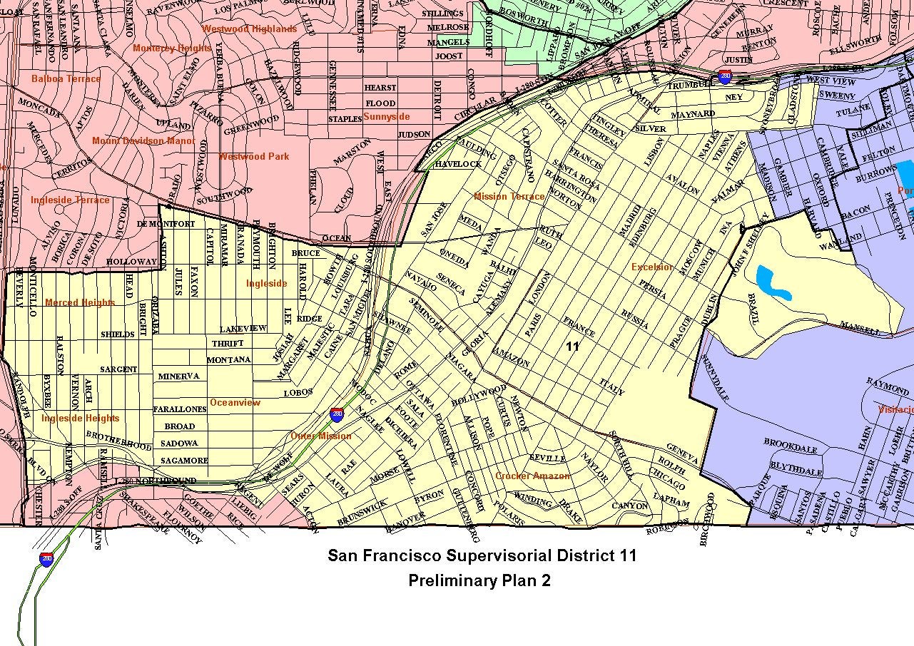
Plan 2 District 11 Map (image)
Public Submissions to the Task Force
Prior to 2000 Census Supervisorial District Statistics
Prior to 2000 Census Supervisorial District Map (image)
Conceptual Maps