Complete List of Plans and Projects
Active Plans & Projects
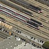 |
4th Street and King Street Railyards Study The Planning Department has received funding from the San Francisco County Transportation Authority to produce a study of air-rights development over the 4th/King railyards. |
 |
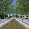
17th & Folsom Proposed Park Site Envisioning New Open Space in the Mission: Proposed Park Site at 17th and Folsom. |
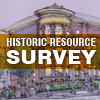 |
Balboa Park Historic Resources Survey The Balboa Park survey is part of the greater Balboa Park Station Area Plan effort. It is located at the convergence of several neighborhoods: Ingleside, Westwood Park, Sunnyside, Excelsior and the Outer Mission. |
 |
Balboa Reservoir Study The Planning Department, the Office of Economic and Workforce Development, (OEWD) and the Public Utilities Commission (PUC) are currently studying options for the development of property owned by the PUC on Balboa Reservoir as part of the Public Land for Housing program. |
 |
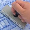
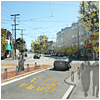
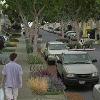
Better Market Street Market Street can and should be a great place. To realize this goal, five key city agencies, together with community partners, are initiating an effort to improve and enhance this public realm. |
 |
Bird-Safe Building Legislation & Standards - Not shown on Map Adopted by the San Francisco Planning Commission on July 15, 2011, the Standards for Bird-Safe Buildings explains the documented risks that structures present to birds. Over thirty years of research has proven the risk to be "biologically significant" for certain bird species. |
 |
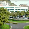
California Pacific Medical Center (CPMC) California Pacific Medical Center is made up of four of the oldest medical centers in San Francisco. State law requires that all acute-care hospitals be seismically upgraded such that they are operational after a major earthquake. |
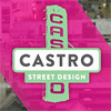 |
Castro Street Design - Not shown on Map This is an interagency planning effort to improve pedestrian conditions on Castro Street between Market and 19th Streets. |
 |
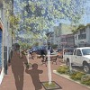
Cesar Chavez East Community Design Plan The Cesar Chavez East Community Design Plan (CCE) will develop a community-supported vision and design for street that is safe, comfortable and accessible to all. |
 |
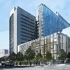
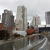
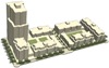
The Central SoMa Plan The Planning Dept has been awarded a Transportation Planning Grant from Caltrans to develop an integrated community vision for the southern portion of the Central Subway rail corridor. (In September of 2013, the Planning Department changed the name of the project from "Central Corridor" to "Central SoMa" to better reflect its geography) |
 |
Central Waterfront - Dogpatch Public Realm PlanSetting the framework for public space improvements in the neighborhood, guiding the investment of impact fees and other sources in the streetscapes and parks which tie the area together. |
 |
Cesar Chavez Street Design The Cesar Chavez Street Design Plan is a detailed design effort to re-envision Cesar Chavez Street from Hampshire to Guerrero Streets in the Mission District. |
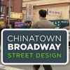 |
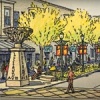
Chinatown Broadway Street Design The Chinatown Broadway Street Design project will develop a community-based vision to improve pedestrian conditions, and develop a design plan that is safe, gracious and lively. |
 |
ENTrips ENTrips is the transportation implementation plan for the Eastern Neighborhoods Plans which will introduce approximately 11,000 new households and 13,000 new jobs into the study area over the next 25 years. |
 |
Environmental Planning CEQA Projects - Not shown on Map The Environmental Planning Division (formerly MEA) of the Planning Department reviews projects for potential environmental impacts on the City of San Francisco and its residents, a process known as environmental review. |
 |
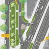
Fisherman's Wharf Public Realm Plan The Fisherman's Wharf Public Realm Plan is an inter-agency partnership, led by the Planning Department, that will help reinvigorate the streets and public spaces of Fisherman's Wharf. A redesigned Jefferson Street will be the central element of the plan. |
 |
Green Connections - Not shown on Map Green Connections will increase access to parks, open space and the waterfront, by re-envisioning City streets and paths as 'green connectors'. |
 |
High Speed Rail - Not shown on Map In November 2008, the voters of California approved Proposition 1A to endorse the California High Speed Rail project. The Planning Department has been involved in a Bay Area Regional Planning effort to bring California High Speed Rail to San Francisco. |
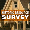 |
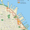
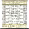
Historic Resources Survey Program - Individual Surveys shown on Map The Historic Preservation division at the San Francisco Planning Department founded its successful preservation program with a goal of understanding the location, distribution, and significance of historic and cultural resources, which include buildings, sites and/or landscapes. This understanding is achieved through the historic and cultural resource survey process. |
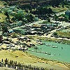 |
India Basin Shoreline Community Planning Process The San Francisco Planning Department and the Redevelopment Agency are in the midst of a collaborative planning process to create new land use controls, design guidelines, and a redevelopment program for the India Basin/Hunters Point Shoreline Plan area. |
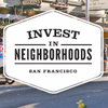 |
Invest in Neighborhoods - Individual districts not shown on Map Invest in Neighborhoods is an interagency partnership to strengthen and revitalize neighborhood commercial districts around San Francisco. The initiative, led by the Office of Economic and Workforce Development (OEWD) currently being piloted in 25 commercial districts, aims to strengthen existing business, improve physical conditions, increase quality of life, and increase community capacity. Invest in Neighborhoods will leverage City programs and resources in order to respond to the specific needs and opportunities in each district. |
 |
Landmark Designation Work Program The Historic Preservation Commission's current Landmark Designation Work Program includes 18 individual properties and three historic districts under consideration for landmark designation. |
 |
Lower Haight Public Realm Plan - Not shown on Map The Plan aims to develop a community-based vision for the neighborhood's public realm and incorporate conceptual streetscape designs to create a more safe, comfortable, and efficient environment for all users, whether they walk, bicycle, use transit, or drive. |
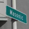 |
Masonic Avenue Street Design Study The primary goal of the Masonic Ave Street Design Study is to identify how Masonic Ave between Geary Blvd and Fell St can safely and efficiently accommodate the needs of all roadway users, including pedestrians, cyclists, motorists and Muni. |
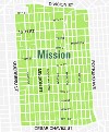 |
Mission Street Study The Planning Department is conducting a study to examine the balance between citywide/regional smart growth goals of increased density and heights around transit in the Mission. |
 |
Parkmerced Project Parkmerced, a 152 acres site in the SW of the city under single ownership was developed between 1941 and 1951 and contains 3,221 housing units. The owner has submitted applications to the City for the long-term comprehensive re-design of the site. |
 |
Pavements to Parks - Individual Parklets shown on Map San Francisco's "Pavement to Parks" projects seek to temporarily reclaim unused swathes of streets and quickly and inexpensively turn them into new public plazas and parks. During the temporary closure, the success of these plazas will be evaluated to understand what adjustments need to be made in the short term, and ultimately, whether the temporary closure should be a long term community investment. |
 |
Plan your own Project! - Not shown on Map The Current Planning division of the San Francisco Planning Department manages the Permitting Process for all large and small-scale development projects. Learn more about how permitting works in San Francisco, or apply for a Permit for a project of your own. |
 |
Polk Streetscape Project - Not shown on Map The Polk Streetscape Project will build on the Polk Street Improvement Project led by the San Francisco Municipal Transportation Agency (SFMTA) to create a complete street design for Polk Street from McAllister Street to Union Street. |
 |
San Jose Avenue Street Design The Planning Department is working with Supervisor Gerardo Sandoval's Office to design traffic calming and pedestrian improvements to a busy stretch of San Jose Avenue, between Highway 280 and Ocean Avenue. |
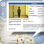 |
San Francisco's 1% For Art Program - Not shown on Map The groundbreaking "Downtown Plan" includes a public art requirement, commonly known as the "1% For Art" program. This requirement, governed by Section 429 of the Planning Code, provides that construction of a new building or addition of 25,000 square feet or more within the downtown C-3 district, triggers a requirement that provide public art that equals at least 1% of the total construction cost be provided. |
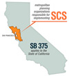 |
SB 375 & the Bay Area's Sustainable Communities Strategy (SCS) - Not shown on Map Senate Bill 375, adopted in October 2008, calls upon each of California's 18 regions to develop an integrated transportation, land-use and housing plan known as a Sustainable Communities Strategy (SCS). This SCS must demonstrate how the region will reduce greenhouse gas emissions through long-range planning. |
 |
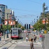
SoMa Streetscape Plan Residential development in the study area has driven the need to balance increased density with the characteristics of a livable neighborhood that include ease of moving about in all modes, and a gracious public realm. |
 |
The Sustainable Development Program - Not shown on Map The program facilitates the implementation of sustainable infrastructure systems that coordinate building development and public infrastructure. A main focus of the Program is to implement district-scale energy, water, and waste systems while balancing the needs associated with growth and land use. |
| Transportation Sustainability Program - Not shown on Map This program was created to better support the City's longstanding Transit First policy by modifying the City's practices relative to development review. |
|
 |
Urban Forest Plan - Not shown on Map The Urban Forest Plan will be a long-term comprehensive plan that sets policy for the management of the City's public and private trees. The Planning Department is working with the Department of the Environment on the Urban Forest Plan. |
 |
Visitacion Valley/Schlage Lock Plan In 1999, the Schlage Lock Company decided to close its Visitacion Valley factory. The now-vacant site presents opportunities for new uses. |
Adopted / Built / Completed Plans & Projects
 |
Balboa Park Station Area Plan The Plan's objective and polices are informed by 3 key principles: 1. Improve the area's public realm; 2.Make the transit experience safer and more enjoyable; 3. Improve economic vitality of the Ocean Avenue Neighborhood Commercial District. |
 |
Bayview Hunters Point Area Plan This plan is a tool for residents and the City to guide the future development of the Bayview Hunters Point district of San Francisco. |
 |
Better Streets Plan - Not shown on Map The Better Streets Plan creates a unified set of standards, guidelines, and implementation strategies to govern how the City designs, builds, and maintains its pedestrian environment. |
 |
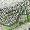
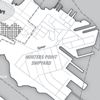
Candlestick Point Sub Area Plan The SubArea Plan envisions a mixed-use development on Hunters Point Shipyard and Candlestick Point that includes new waterfront parks, new housing, extensive retail and research and development space and a site for a potential new stadium for the 49ers. |
 |
East SoMa Area Plan The intent of this Plan is to keep East SoMa a place of mixed uses, where new affordable and market rate housing, offices and retail can mix with viable production, distribution or repair businesses, and small institutions. |
 |
Eastern Neighborhoods The Eastern Neighborhoods Program calls for transitioning about half of the existing industrial areas in the Mission, Central Waterfront, East South of Market and Showplace Square/Potrero Hill neighborhoods to mixed use zones that encourage new housing. |
 |
Executive Park Neighborhood Plan Plans are afoot to transform Executive Park, the unrealized office park east of Highway 101, into San Francisco's newest residential neighborhood. |
 |
Glen Park Community Plan The focus of the Plan is the 'village' or downtown Glen Park – the small cherished but challenged center of the neighborhood and source of great community pride. |
 |
Health Care Services Master Plan - Not shown on Map The HCSMP is intended to identify the current and projected needs for – and locations of – health care services within San Francisco; the HCSMP also includes recommendations on how to achieve and maintain appropriate distribution of and equitable access to health care services. |
 |
Japantown Cultural Heritage and Economic Sustainability Strategy The Cultural Heritage and Economic Sustainability Strategy is about developing the vision for the Japantown neighborhood, focusing on economic development, preserving and enhancing the historic and cultural uses and buildings, and making physical improvements. |
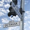 |
Market & Octavia Area Plan The objective of the Plan is to create a land use plan that embraces the Market and Octavia neighborhood's potential as a mixed-use urban neighborhood. |
|
Mission Area Plan To ensure the Mission remains a center for immigrants, artists, and innovation, the established land use pattern should be reinforced. |
 |
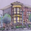
Mission District Streetscape Plan The Mission District Streetscape Plan is a community-based planning process to identify improvements to streets, sidewalks and public spaces in the city's Mission District. |
 |
Northeast Embarcadero Study The intent of the Northeast Embarcadero Study is to guide the development of properties along the west side of The Embarcadero, from Washington Street to North Point Street, in a common direction. |
 |
Rincon Hill Area Plan This is a plan for the emergence of a new mixed-use neighborhood on Rincon Hill, a twelve-block area close to downtown. Rincon Hill is south of the Financial District and Transbay District, and north of the South Beach neighborhood. |
 |
Showplace Square Open Space Plan The Showplace Square Open Space Planning Process is intended to identify, design, and prioritize the community's open space needs. |
 |
Showplace Square/Potrero Area Plan The objective of this plan is to encourage the transition of portions of Showplace/Potrero to a more mixed use and neighborhood-serving character, while protecting the core of design-related PDR (production, distribution, repair) uses. |
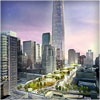 |
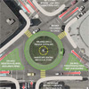
Transit Center District Plan This Plan will build on the City's renowned 1985 Downtown Plan that envisioned the area around the Transbay Terminal as the heart of the new downtown. |
 |
Upper Market Community Plan In the fall of 2007, residents, developers, merchants, community members, and planners worked together in a series of community planning workshops to create a community vision for the Upper Market. |
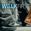 |
WalkFirst Project - Not shown on Map The WalkFirst project will identify key walking streets throughout San Francisco and establish a criteria to prioritize pedestrian improvements in order to improve pedestrian safety and walking conditions, encourage walking, and enhance pedestrian connections to key destinations. |
 |
Western SoMa Community Plan The Western SoMa Citizens Planning Task Force shall promote neighborhood qualities and scale that maintain and enhance, rather than destroy, today's living, historic and sustainable neighborhood character. |