Local Coastal Program Amendment
San Francisco's Local Coastal Program amendment was approved by the California Coastal Commission on May 10th, 2018 and is now in effect. The amended plan can be found here.
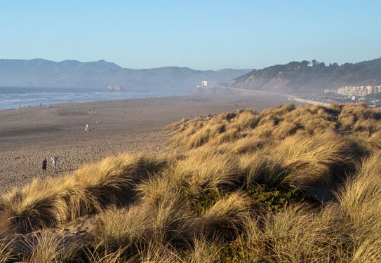
The San Francisco Coastal Zone extends approximately 6 miles along the western shoreline, from the Point Lobos recreational area in the north to the Fort Funston cliff area in the south.
The Local Coastal Program Amendment is an update to the 1986 Western Shoreline Area Plan that will specifically address sea level rise and coastal erosion concerns along the area.
photo credit: AECOM
Portions of San Francisco's dynamic Ocean Beach – particularly the area between Sloat and Skyline boulevards – have experienced substantial erosion over the past few decades. Shoreline erosion has already damaged the Great Highway and beach parking lots and threatens to damage critical wastewater system infrastructure. Sea level rise and the increased frequency and severity of coastal storms anticipated due to global climate change will likely exacerbate these effects in the decades to come.
The Local Coastal Program (LCP) is a policy and regulatory document required by the California Coastal Act that establishes land use, development, natural resource protection, coastal access, and public recreation policies for San Francisco's Coastal Zone. San Francisco's Local Coastal Program was originally certified in 1986. The policies of the LCP were incorporated into the Western Shoreline Area Plan, the element of the General Plan that establishes land use, development, and environmental policies for this area.
In 2015, San Francisco Planning secured funding from the California Coastal Commission and the Ocean Protection Council to lead the effort to amend the Western Shoreline Area Plan, specifically to address climate change, sea level rise, and coastal erosion concerns.
Using the best available science, San Francisco amended its Local Coastal Program to provide for long-term resiliency by balancing environmental resources, maintaining coastal access, addressing community needs, and protecting our investment in public infrastructure, such as roads and wastewater treatment facilities. The LCP amendment covers the entire Coastal Zone, but implementation will largely occur south of Sloat Boulevard, where coastal vulnerabilities are most acute.
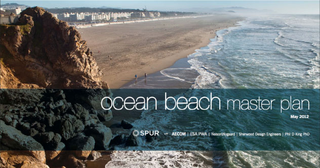
Ocean Beach Master Plan
The LCP Amendment will define the City's approach for implementing the sea level rise and coastal erosion recommendations in the Ocean Beach Master Plan (OBMP), an interagency effort to develop a sustainable long-term strategy for Ocean Beach. The Plan represents the cooperation and involvement of SPUR, San Francisco Planning, federal, state, and local agencies, and community stakeholders in addressing seven focus areas: ecology, utility infrastructure, coastal dynamics, image and character, program and activities, access and connectivity, and management and stewardship.
The City's plan for Ocean Beach must be adopted by the San Francisco Planning Commission and Board of Supervisors prior to review and certification by the California Coastal Commission as an amendment to San Francisco's Local Coastal Program.
 The Ocean Beach Master Plan recommendations focus on six "Key Moves":
- Reroute the Great Highway behind the San Francisco Zoo via Sloat and Skyline Boulevards*
- Introduce a multipurpose coastal protection/restoration/access system*
- Reduce the width of the Great Highway to provide amenities and facilitate managed retreat
- Restore the dunes along the middle reach
- Create a better connection between Golden Gate Park and Ocean Beach
- Introduce bicycle and pedestrian improvements north of Balboa Street
Planning and Approval Process for Completing the LCP Amendment
Extensive community outreach and involvement took place throughout this process, including several public meetings and a Community Advisory Group.
The amendment was heard by the San Francisco Planning Commission, Board of Supervisors, and the California Coastal Commission in 2017 and 2018, with final Coastal Commission certification in May 2018. The adopted Coastal Hazards policies can be found here.
Public Involvement/Timeline
Since the Project Launch in fall 2015, there have been a series of public meetings and hearings conducted by both San Francisco and the California Coastal Commission.
| STEP 1 - Project Launch | Fall 2015 |
|
| STEP 2 - Sea Level Rise Data Summary |
Spring 2016 |
|
| STEP 3 - LCP Amendment Scope Definition |
Spring-Summer 2016 |
|
| STEP 4 - Policy Development Public Review |
Spring-Fall 2016 |
|
| STEP 5 - Local Approval Process | 2017-2018 |
|
| STEP 6 - California Coastal Commission Approval Process |
2018 |
|
Coastal Zone Map
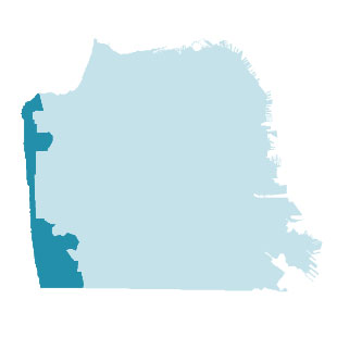
The San Francisco Coastal Zone extends approximately 6 miles along the western shoreline from the Fort Funston cliff area in the south to the Point Lobos recreational area in the north. The south end of the Coastal Zone includes the Lake Merced area, the Zoo, the Olympic Club, and the seashore and bluff area of Fort Funston. The Coastal Zone spans the Ocean Beach shoreline and includes Golden Gate Park west of Fortieth Avenue, the Great Highway corridor and the adjacent residential blocks in the Sunset and Richmond districts. The north end of the seashore includes the Cliff House and Sutro Baths area, Sutro Heights Park, and Point Lobos recreational area.
Documents
Background Documents
- October 5, 2017 Planning Commission Adoption Hearing Packet
- March 2, 2017 Planning Commission Initiation Hearing Packet
- Fact Sheet 12MB (Spring 2017)
- Coastal Protection Measures and Management Strategy for South Ocean Beach (2015)
- Ocean Beach Master Plan
- Western Shoreline Area Plan
Existing Shoreline Management Plans
- Public Works Plan for San Francisco Wastewater Management Program (1979)
- Interim Ocean Beach Shoreline Protection Coastal Development Permit (2015)
- Draft San Francisco Littoral Cell Coastal Regional Sediment Management Plan (2016)
Sea Level Rise
- Sea Level Rise Future Conditions and Mapping Pilot Study (2016)
- Sea Level Rise Existing Data and Analyses Technical Memorandum (2016)
Transportation
Application Packet
Contact
To receive updates about the LCP Amendment process and announcements about upcoming public meetings, sign up for automated email notifications, or contact:
Maggie Wenger
LCP Amendment Project Manager
SF Planning Department
maggie.wenger@sfgov.org
(415) 575-9126
The LCP Amendment is largely funded by a grant from the California Coastal Commission and the Ocean Protection Council.