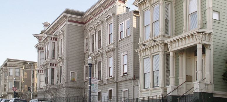
Historic Resources Survey Program
Only a small fraction of San Francisco's historic and cultural resources have been identified.
The foundation of a successful preservation program is an understanding of the location, distribution, and significance of historic and cultural resources, which include buildings, sites and/or landscapes.
This understanding is achieved through the historic and cultural resource survey process, described in more detail in Preservation Bulletin No.11. In addition to identifying important individual historic or cultural resources and potential districts, a survey can help identify buildings that qualify for local or national preservation incentives or inform the development of neighborhood-specific guidelines that protect neighborhood character.
To facilitate these and other preservation efforts, the Planning Department has established the Comprehensive Citywide Cultural and Historical Resource Survey (Survey Program) to manage and conduct historic and cultural resource surveys. A typical Planning Department Area Plan survey includes the development of a Historic Context Statement, documentation and evaluation of buildings on DPR-523 forms, and identification of potential Historic Districts and individually significant properties. This level of documentation and evaluation helps inform the public, property owners, government officials, and those who do business in San Francisco, making environmental review more transparent.
For information on historic and cultural resource surveys, please see the Survey Program's Frequently Asked Questions, or the Survey Work Plan.
In addition, the Survey Program has recently embarked upon development of the San Francisco Citywide Historic & Cultural Context Statement (SF Context Statement). The SF Context Statement will facilitate and guide the completion of neighborhood and thematic surveys, as well as evaluations of individual properties, in all areas of San Francisco. It will provide a comprehensive framework for surveying, identifying and evaluating San Francisco's historic and cultural resources. For more information, see the SF Context Statement Work Plan.
Surveys and Historic Context Statements
The Planning Department's Survey Program focuses primarily on areas which are subject to long-range planning efforts, such as Area Plans and Better Neighborhoods Plans. Additional surveys address neighborhoods or topics that are also important for planning purposes. The table below includes a list of both current and completed historic surveys. For a PDF map of completed Planning Department survey areas, as well as other historic surveys in San Francisco, click here.
The Department also maintains a library of older historic survey documents, as well as surveys not sponsored by the Planning Department. To learn more, click here.
| Survey Name | Details | Status |
|---|---|---|
|
The Central SoMa Historic Resources Survey began in 2013 as a planning effort associated with the Central SoMa Plan. It focuses primarily on buildings that were constructed 45 or more years ago, and that have not been addressed by prior survey efforts. The two primary features of this survey are the preparation of historic context statement and a reconnaissance level historic survey. The draft survey results are available here. |
Current |
|
|
In 2014, the Planning Department began The Neighborhood Commercial Buildings Historic Resource Survey under a grant from the California Office of Historic Preservation. The first phase focused solely on neighborhood commercial buildings constructed prior to 1965, which may be subject to the recently enacted mandatory seismic retrofit program for soft-story buildings. The second phase, begun in 2015, will examine commercial buildings located in San Francisco's neighborhood commercial zoning districts. |
Current |
|
|
The Automotive Support Structures Survey was designed to document early automotive support structures. The project began in 2008 and focused on areas along the multi-block Van Ness Avenue corridor, from Mission to Pacific Streets. These often low-rise buildings are a rare and vulnerable property type, and are located in an area facing increased development pressure. Both the survey results and a historic context statement were combined in a report entitled Van Ness Auto Row Support Structures. Overall, the survey resulted in the documentation of 112 properties with DPR 523A and DPR523B survey forms which can be viewed here. A DPR 523D form was also completed for the Pine Street Auto Shops Historic District. Click here for a copy of the Planning Department's Survey Case Report. |
Completed The survey was adopted by the Historic Preservation Commission on July 21, 2010. |
|
|
Balboa Park is located at the convergence of several neighborhoods: Ingleside, Westwood Park, Sunnyside, Excelsior and the Outer Mission. The Balboa Park survey was part of the greater Balboa Park Station Area Plan. The survey focused on buildings located along and adjacent to the Ocean Avenue corridor (see the survey area map). The history of Balboa Park's development was documented in the draft Balboa Park Historic Context Statement. The survey documented 66 properties with DPR 523A forms, and 15 properties with the more intensive DPR 523B forms, as well as DPR 523D (District) forms for the Ocean Avenue commercial corridor and Balboa Park. Results from this survey are expected to be reviewed before a public hearing at the Historic Preservation Commission in 2015. |
Completed |
|
|
|
The Central Waterfront Historic Survey was a component of the Central Waterfront Area Plan and completed in 2000-2001 by the Planning Department in association with the Dogpatch Neighborhood Association. The survey boundaries encompassed the area from Mariposa Street south to Islais Creek, and from I-280 east to the Bay. The survey generated DPR 523A and DPR 523B survey forms for all properties built before 1956 within the plan area. The history of the area was also documented in the Central Waterfront Cultural Resources Survey Summary Report and Draft Context Statement. A significant residential enclave identified by the survey was subsequently listed as the Dogpatch Historic District. under Article 10 of the Planning Code. The Department's 2001 survey was updated in 2007-2008 to include the completion of a historic district record for the industrial area outside of both Pier 70 and Dogpatch, and to update DPR 523B forms with current historic resource status codes. The Port of San Francisco independently opted to seek consultant services to address Port-owned properties at Pier 70. As part of this, the Union Iron Works Historic District was added to the National Register of Historic Places on April 17, 2013. Click here to view the Pier 70 Master Planning web page. |
Completed The Central Waterfront Survey was adopted by the Landmarks Preservation Advisory Board on December 5, 2001. |
|
The Civic Center Cultural Landscape Inventory provides information about historic landscape features that contribute to the Civic Center Historic District. These include public plazas, trees, pathways, and lighting, as well as other features that make the Civic Center a vital center of activity in San Francisco. The information will help inform planning decisions and encourage consistent design and maintenance of the Civic Center Historic District. Projects within Civic Center are managed by various groups including: the San Francisco Planning Department, Recreation & Parks Department, Public Utilities Commission, Municipal Transportation Agency, Department of Public Works, and local partners. Click here for a copy of the Civic Center Cultural Landscape Inventory Report |
Completed The Civic Center Cultural Landscape Inventory was adopted by the Historic Preservation Commission on September 16, 2015. |
|
|
The Inner Mission North Survey was conducted by Planning Department staff as one of several planning studies used to inform the Mission Area Plan. The survey area was bounded approximately by Duboce Avenue and Market Street to the north, 20th Street to the south, Folsom Street to the east, and Dolores Street to the west. The Inner Mission North Survey included the documentation and assessment of more than 2,000 individual buildings and several historic districts that are located within the area. Click here for a copy of the Planning Department's Survey Case Report. |
Completed The Inner Mission North Survey was adopted by the Historic Preservation Commission on June 1, 2011. |
|
|
The Japantown Historic and Cultural Resource Survey began in 2007 and was conducted in association with the Japantown Better Neighborhood Plan, a long-range planning effort undertaken jointly by the Japantown community and the Planning Department. As part of the survey, a Historic Context Statement was prepared to document the history of the area and inform the survey findings. The survey documented over 500 individual properties on DPR 523A forms. More intensive research was conducted for selected properties using draft DPR 523B forms and a draft DPR 523D form. The survey results have not been adopted by the Historic Preservation Commission. The Japantown community and the Planning Department are reviewing the survey evaluations to better understand how the findings will integrate with the Japantown Better Neighborhood Plan in preserving the essential historic and cultural character of Japantown while also meeting other community objectives. |
Completed This context statement was subsequently adopted by the Historic Preservation Commission on September 18, 2013. |
|
|
The Market and Octavia survey was part of the larger Market and Octavia Area Plan. Beginning in 2006, the Planning Department contracted with consultants Page & Turnbull to survey the Area Plan boundaries. These included portions of several neighborhoods, including Hayes Valley, the Mission, SoMa, Civic Center, Upper Market, Duboce Triangle and Duboce Park, Lower Haight, Castro and the Western Addition. See the survey map. A Historic Context Statement was prepared to document the history of the area and inform the survey findings. The survey focused on buildings constructed before 1962 which had not been previously surveyed. A total of 1,563 buildings were documented with DPR 523A forms. Individual evaluations for 155 buildings were also made using DPR 523B forms, and 736 buildings were evaluated as part of a group or district on DPR 523D forms (click here for a map of identified historic districts). The survey also resulted in updates to the previously identified Hayes Valley Residential Historic District, including Update #1 and Update #2. The historic context statement and survey findings were endorsed by the Landmarks Preservation Advisory Board at a public hearing on December 19, 2007. |
Completed These findings were adopted by the Planning Commission on February 19, 2009. |
|
|
The San Francisco Modern Architecture and Landscape Design 1935-1970 Historic Context Statement was funded in part by a grant from the California Office of Historic Preservation. The Planning Department developed the context statement in order to provide a framework for consistent, informed evaluations of San Francisco's Modern buildings and landscapes. The context statement links specific property types to identified themes, geographic patterns, and time periods. It also identifies character‐defining features and documents significance, criteria considerations and integrity thresholds. |
Completed The context statement was adopted by the Historic Preservation Commission on February 2, 2011. |
|
|
The Showplace Square / Northeast Mission Survey focused on a largely industrial area touched by two adjacent planning efforts: the Northeast Mission portion of the Mission Area Plan, and the Showplace Square / Potrero Hill Area Plan. The survey was conducted by Planning Department staff in conjunction with local preservation consultants Kelley and VerPlanck. A historic context statement was prepared in conjunction with the survey, which found that Showplace Square and the Northeast Mission share a similar development history characterized by commercial and industrial building stock. The survey documented 633 properties using DPR 523A forms. Two historic districts were also identified and documented with DPR 523 D forms. For links to the survey results, including an interactive survey map and other resources, go to the Showplace Square/Northeast Mission Survey page. Click here for a copy of the Planning Department's Survey Case Report. |
Completed The Showplace Square Survey was adopted by the Historic Preservation Commission on August 17, 2011. |
|
|
The South Mission Survey was one of several planning studies used to inform the Mission Area Plan. It was conducted by Planning Department staff with assistance from local consultants Page & Turnbull. The survey boundaries included the area bounded approximately by 20th Street, Cesar Chavez Street, Potrero Avenue and Guerrero Street. A Historic Context Statement was prepared to document the area's development and identify significant themes and property types. In total, the survey documented approximately 3,800 individual buildings, including nearly 1,000 individual historic properties and 13 historic districts. For an interactive map of surveyed properties and links to the survey forms, click here to visit the South Mission Historic Resource Survey page. Click here for a copy of the Planning Department's Survey Case Report. |
Completed The South Mission Survey was adopted by the Historic Preservation Commission on November 17, 2010. |
|
|
The South of Market (SoMa) Area Historic Resources Survey included properties in the area bounded approximately by Market Street, Townsend Street, 1st Street and 13th Street. Although these boundaries touched on separate planning areas in East and West SoMa, a study by the Western SoMa Citizen's Planning Task Force determined that the area featured similar building stock. Thus, a single survey was used to benefit both planning efforts. A historic context statement was prepared to document the development history of the area and inform the survey findings. The SoMa Survey assessed 2,142 individual properties, including approximately 1,467 properties constructed before 1963. Several historic districts were also identified, including the Western SoMa Light Industrial & Residential District. Click here for a copy of the Planning Department's Survey Case Report. |
Completed The findings of the SoMa Survey were adopted by the Historic Preservation Commission on February 16, 2011. |
|
|
In 2012 the Planning Department developed a Historic Context Statement focused on the Sunset District's prolific builder-developers and the residential tracts they constructed from the 1920s through the mid-20th century. The context statement was used to inform the results of evaluative survey of 2,762 single-family houses in the Sunset District constructed from 1925 to 1950. This included documenting clusters of eligible historic districts, as well as individually eligible historic buildings. Importantly, the Sunset survey also documented and evaluated buildings that do not qualify as eligible historic resources. Data collection was completed in 2013 and summarized in the Planning Department's Survey Case Report. |
Completed The survey results were adopted by the Historic Preservation Commission on September 18, 2013. |
|
|
The Transit Center District Survey (Transbay Survey) was part of the larger Transit Center District Plan. The survey focused on an area in the South of Market facing increasing development pressure, bounded by Market, Main, Tehama, and New Montgomery Streets. At its center was the 1939 Transbay Terminal, a commuter bus station which was demolished and is to be replaced with a new office tower and multi-modal transit center. In 2008 a historic context statement was prepared for the area to help guide the identification of significant historic and architectural resources. The surveyed buildings were documented with DPR 523 A and B forms. The survey also identified the New Montgomery, Mission and Second Street Historic District, which was locally listed under Article 11 of the Planning Code. On August 20, 2008 the context statement and survey findings were endorsed by the Landmarks Preservation Advisory Board. To view the plan's historic preservation policies and other materials, visit the Transit Center District Plan Historic Preservation page. |
Completed On February 1, 2012, the Transit Center District Historic Resources Survey Update was adopted by the Historic Preservation Commission. |
Contacts
Tim Frye
Historic Preservation Officer
Shannon Ferguson
Preservation Technical Specialist
Desiree Smith
Preservation Technical Specialist