ALIGN: CEQA Reform

California and San Francisco set out to establish a modernized environmental planning process that takes a more universal approach to how we calculate the effects of transportation. This will ensure that when we assess the impacts of projects, we are better equipped to recognize the effects they have on the transportation system and associated outcomes, such as whether a project encourages more people to travel long distances in a car, or if it provides safe and effective alternatives to driving.
On March 3, 2016, the San Francisco Planning Commission adopted a resolution to replace LOS with a vehicle miles traveled threshold for all CEQA environmental determinations. The resolution allows San Francisco to immediately implement changes to how it analyzes environmental impacts of development and transportation projects rather than wait for state adoption.
Vehicle Miles Traveled
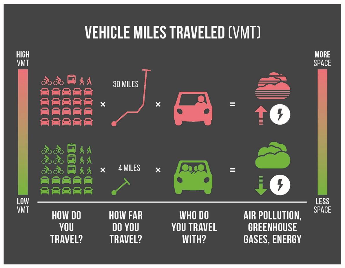
Vehicle miles traveled per person (or per capita) is a measurement of the amount and distance that a resident, employee, or visitor drives, accounting for the number of passengers within a vehicle. Many interdependent factors affect the amount and distance a person might drive. In particular, the built environment affects how many places a person can access within a given distance, time, and cost, using different ways of travels (e.g., private vehicle, public transit, bicycling, walking, etc.). Typically, low-density development located at great distances from other land uses and in areas with few options for ways of travel provides less access than a location with high density, mix of land uses, and numerous ways of travel. Therefore, low-density development typically generates more VMT compared to development located in urban areas.
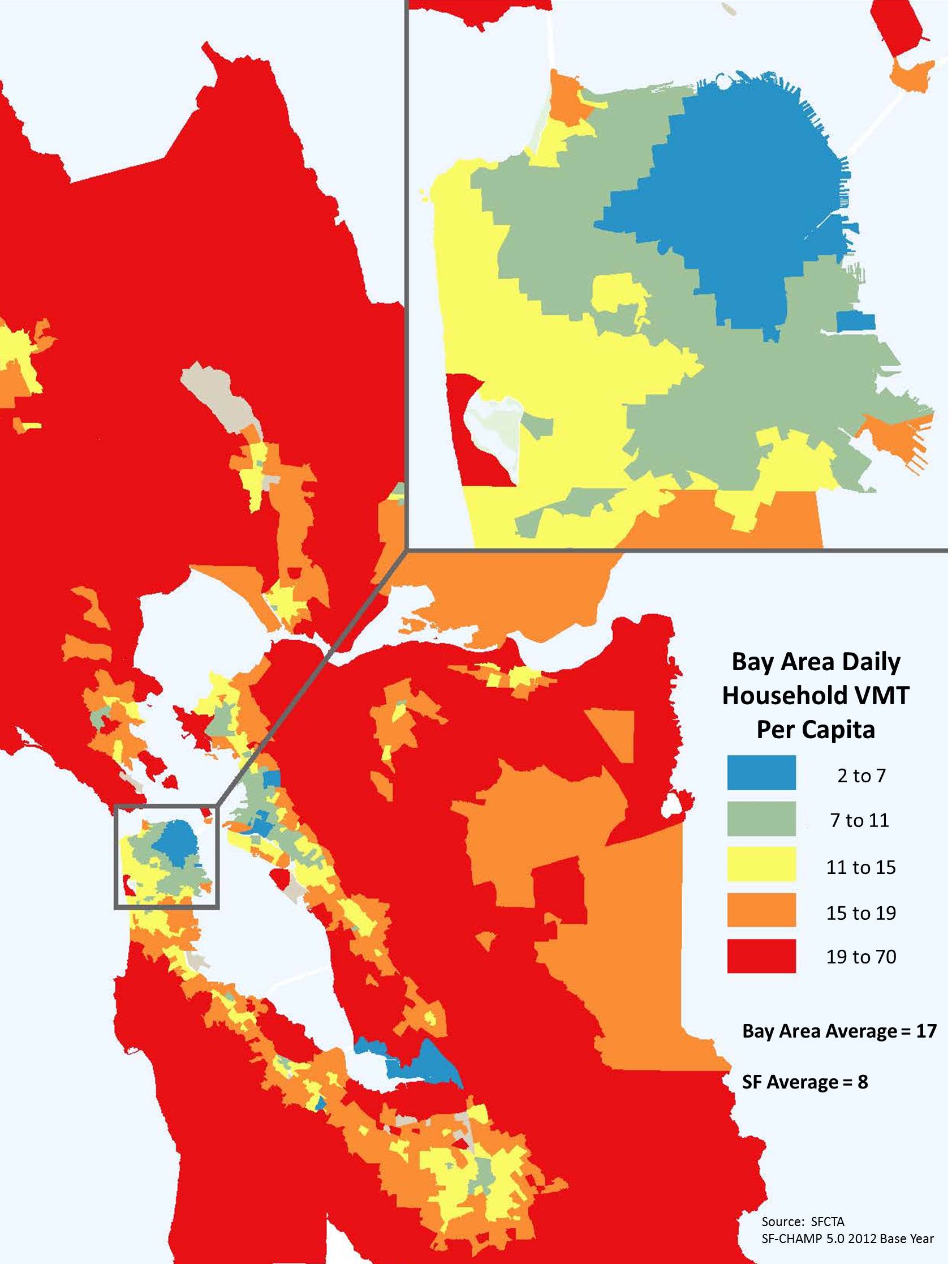
Given these travel behavior factors, on average, persons living or working in San Francisco result in lower amounts of VMT per person than persons living or working elsewhere in the nine-county San Francisco Bay Area region. In addition, on average, persons living or working in some areas of San Francisco result in lower amounts of VMT per person than persons living or working elsewhere in San Francisco.
Frequently Asked Questions
Resources and Press
- March 3, 2016 Planning Commission Staff Report regarding Align
- Background on CEQA Transportation Analysis
- Op-Ed: Adopt 'miles traveled' measure to discourage harmful sprawl (SF Chronicle)
- Development Rules: new state guidelines that would change traffic studies required for projects (SF Gate)
- Transit Projects Are About to Get Much, Much Easier in California (The Atlantic - CityLab)
- TSP Rebooted: Bureaucratic Revamp Could Boost Transit and Livable Streets (Streetsblog)
- Press Release: San Francisco Planning Takes Lead in Modernizing Environmental Review for New Development Projects