Inner Mission North Historic Resource Survey
Overview
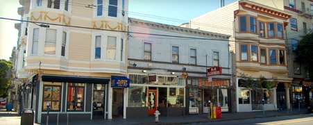
The Inner Mission North Survey is being conducted by Planning Department staff as one of several planning studies that will be used to inform the implementation of the Mission Area Plan. The Inner Mission North Survey includes documentation and assessment of more than 2,000 individual buildings and several historic districts that are located within the area that is bounded approximately by Duboce Avenue and Market Street to the north, 20th Street to the south, Folsom Street to the east, and Dolores Street to the west. The Inner Mission North was completed and presented to the Historic Preservation Commission for adoption in May 2011.
For more information regarding the Inner Mission North Survey, please contact:
Tim Frye
Historic Preservation Officer
(415) 575-6822
tim.frye@sfgov.org
The Department has created an interactive "Google Map" a custom application to navigate around the survey area and find survey parcels. You can view survey results and materials for specific properties and areas. To use the map, click here.
Survey Results
|
Proposed Historic Resource Survey Findings
|
||
|---|---|---|
| 0.5 MB | ||
| 0.1 MB |
|
Proposed Historic Districts
|
||
|---|---|---|
| 1.5 MB | ||
| 1.5 MB | ||
|
2.7 MB | |
|
4.2 MB | |
| 2 MB | ||
| 1.5 MB | ||
| 1.7 MB | ||
| 1.9 MB | ||
|
12.5 MB | |
|
3 MB | |
| 1 MB | ||
| 1 MB | ||
| 1 MB |
|
Background Survey Materials
|
||
|---|---|---|
|
5.7 MB | |
|
3.7 MB |