Conceptual Map Overview
The Conceptual Maps illustrate five possibilities for redrawing San Francisco"s 11 supervisorial districts to comply with 2000 Census results.
Federal law and the San Francisco City Charter require that-within certain limits-districts be drawn to make them as even as possible in population. Several other criteria, or goals, may also be taken into account when drawing districts. Each of these maps illustrates the result of using a different goal-and only that goal-to redistrict San Francisco.
Please note: these plans are for illustration only. They are intended to stimulate community discussion and engage citizens in the redistricting process. The Elections Task Force on Redistricting will approve San Francisco"s final district plan only after the public has extensive opportunity to provide input.
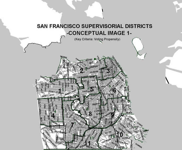
Conceptual Map 1: Place High- and Low-Propensity Voters in Different Districts
Citizens vote with varying frequency, or propensity. Therefore, districts that combine residents who are very likely to vote with those who are very unlikely to vote create the possibility that the high-voting residents will have an advantage in district-wide elections. The primary goal of Conceptual Map 1 is to place high- and low-propensity voters into different districts to the greatest extent possible.
View Conceptual Map 1 (image)
View Conceptual Map 1 Statistics
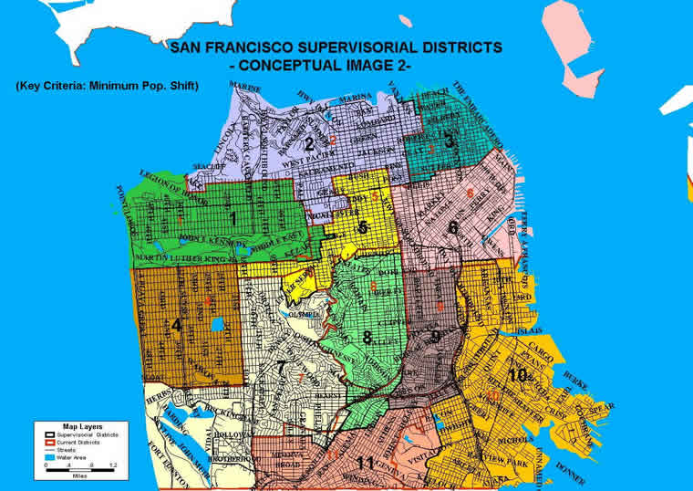
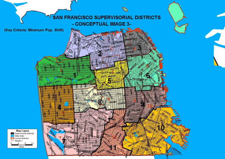
Conceptual Maps 2 and 3: Shift as Few People as Possible into New Districts
In these two Conceptual Maps, the primary goal is to minimize the number of residents shifted from one district to another by the redistricting process. There are many ways to do this; Map 2 and Map 3 are only two examples.
View Conceptual Map 2 (image)
View Conceptual Map 2 Statistics
View Conceptual Map 3 (image)
View Conceptual Map 3 Statistics
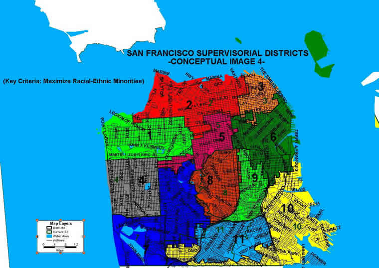
Conceptual Map 4: Maximize the Chance of Electing Racial and Ethnic Minorities
In Conceptual Map 4, the primary goal is to group the city"s African-American, Asian-American, and Latino communities in such a way as to maximize the likelihood of electing members of these communities to the Board of Supervisors. This type of approach might have been required in the late eighties/early nineties, but is considered more constitutionally suspect since the U.S. Supreme Court"s 1993 decision in Shaw v. Reno.
View Conceptual Map 4 (image)
View Conceptual Map 4 Statistics
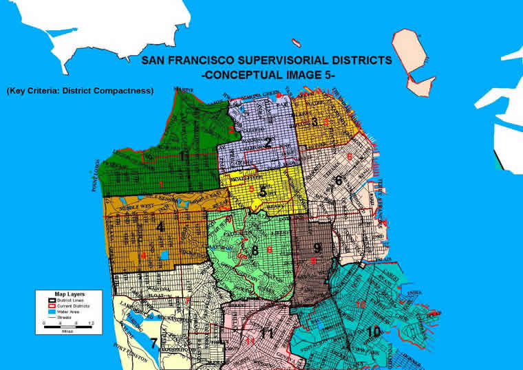
Conceptual Map 5: Make Districts as Compact as Possible
Another standard that can be used in drawing districts is to make them as compact as possible. This was the criterion used to draw the districts in Conceptual Map 5.
View Conceptual Map 5 (image)
View Conceptual Map 5 Statistics